November 27, 2016
Hiking all the trails for a particular area can take one to obscure places they would normally not even think about visiting. Cooper Creek Trail is located on a sliver of North Carolina, abutted on three sides by different jurisdictions: the Cherokee Indian Reservation, N.C., and the National Park.
The trail is fairly level and only .5 miles long. To get there you have two options: 1) hike from Deep Creek or Mingus Creek or 2) drive up Coopers Creek Road from Bryson City, which involves crossing private property. I know Bryson, and had no desire to drive up in a holler on a Sunday afternoon after Thanksgiving.
As crazy as it sounds, I hiked 16 miles to hike a ½ mile trail. Starting at Deep Creek, I hiked Indian Creek Trail and Deep Low Gap. This still leaves 2.4 miles left to hike on Deep Low Gap, so I will save my pictures for when I finish it and write about that entire trail.
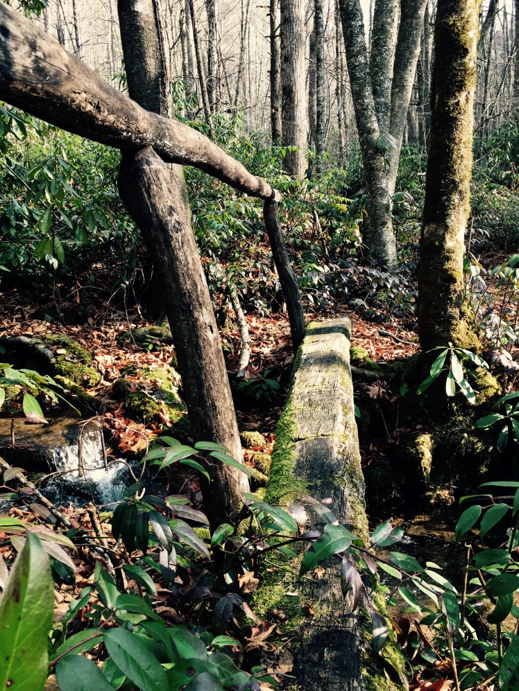
Cooper Creek Trail turns into a creek for part of the trail (pictured below). It’s quite a nice path, but near the southern terminus I was confronted by the chattel of the local inhabitants. On the adjacent, non-federal property were tarps, old machinery, cabins with broken windows and the discarded junk of yesteryear.
I again was affirmed for making the right choice of hiking, in lieu of driving to Cooper Creek.
GPS link: https://www.movescount.com/moves/move132655343
Total mileage is 16.23 miles.


I think you made a good choice with the hike vs drive. I would do the same.
LikeLiked by 1 person
Definitely! on a different note, we’re so sad about the loss of life and damage to GSMNP. Hoping the fire gets under control soon.
LikeLike
Awesome pictures.
LikeLiked by 1 person
Thank you! That’s very kind.
LikeLiked by 1 person
I love it. Hiking 16 miles to hike the half mile trail. The trials and tribulations on trying go deep on a day hike.
LikeLiked by 1 person